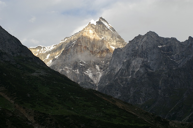
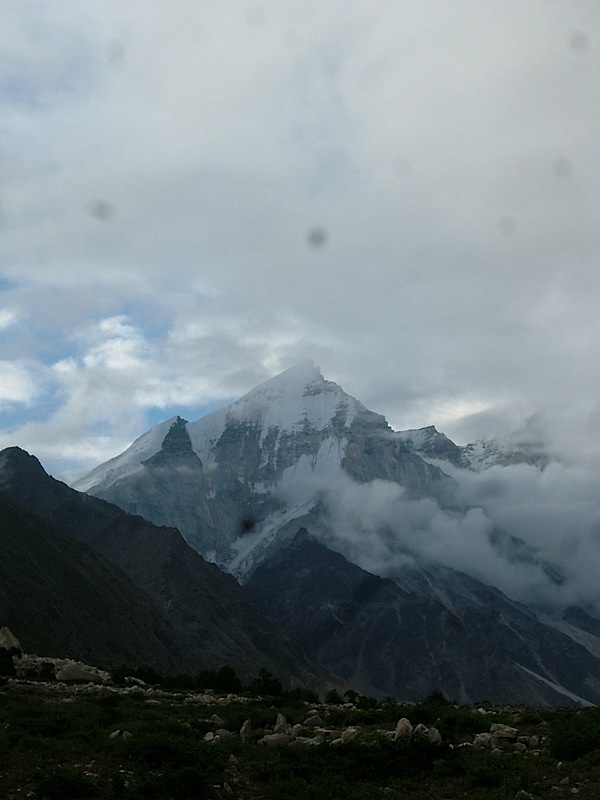
And here's the Bhagirathi group, in a rare clearish moment:
After chai and some grub, we set out for Gaumukh, the head of the huge Gangotri glacier and the source of the Bhagirathi river. The glacier is continuously receding (global warming?) and so the walk from Bhojbasa has got longer and longer over the years. We tramped about 4 or 5 km along a rubbly path until we got to the immense wall of ice marking the end of the Gangotri glacier. Here are some pics:
 |  |
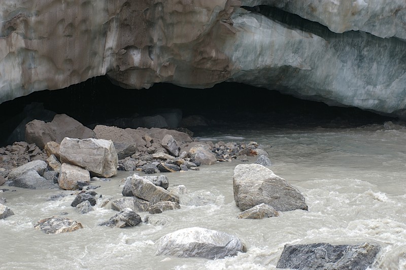 |  |
Yes, everything in the top two-thirds of the first picture is ice. Rocks and bits of ice were constantly falling off the glacier into the water. While we were there, a car-sized chunk (possibly the one in the last picture) fell off with an almighty splash, soaking everyone around in a huge plume of ice-cold water. Thankfully we had moved out of range of the deluge a few minutes ago, and those in range seemed uninjured, though sodden and shivering.
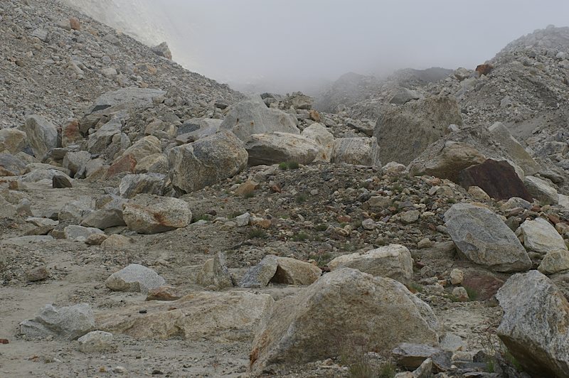
After spending some time at Gaumukh, we headed up the lateral moraine (why must all moraines look like bombsites?) towards Nandanvan. We caught stunning views of the crevassed Gangotri glacier, and crossed rubble and sand. Here's some terrain (the "path" is on the left side of the picture):
At one point, the trail wound right under a huge landslide zone. I was walking alone, and decided enough was enough, and it would be suicidal to try to cross it alone. So I waited a good 20 mins or on top of a small hummock in the other direction (figuring this was the safest place to be if there was a slide) until Mahavir, one of our porters, turned up and we crossed together.
Our first glacier crossing followed shortly after. This was my first time on a glacier, and while everything seemed hunky dory there was the happy thought that if I fell and slid, I was headed straight for a churning, crashing stream 50 metres below. After some zigzagging, I found myself balancing on the edge of a drop of about 6 feet on sheer ice. I looked at Mahavir for directions. "Jump!" he yelled, "Don't let your feet leave the ground!" Both seemed impossible to accomplish together, so I consigned my soul to the afterworld and and tried a dainty little run down the steep slope. Needless to say, I slid and landed heavily (monstrously heavy backpack-heavily) on my feet, my knees feeling for a moment as if they'd popped their sockets. So much for the pleasures of glacier travel -- my knees grumbled accusingly. On the bright side, at least the slide hadn't extended all the way to catastrophe.
The less said about the last kilometre or so the better. In short, it was steep, and tough. I was realizing with every step that I was not quite as fit as I thought I was, and was pretty much in a daze, putting one foot above another. A couple of porters who had reached earlier came back and offered to help us with our loads, but I refused and plodded on. This got me into trouble with Vishnoi, who had sent the porters back and thought quite rightly that undue strain was not recommended. However, at least I got to Nandanvan, pack and all. Nandanvan (4337m) is a beautiful green meadow with rocks strewn around and little streams running through it. I was dog tired and altitude sick (splitting headache), and after a while drifted off to sleep without dinner.
(Part 5)
9 comments:
the image of you falling on that glacier is not such a happy thought...
very dangerous..
and without dinner is NEVER a good idea.
all great directives in my privileged position of knowing that the story has a happy end, of course.
will stop lecturing.
gaumukh looks wild and lovely as usual. i rather love this river.
So I wonder what'd have happened to me...with my asthma.
Btw, did I tell you...the last trek we went to was a night one. The initial (and steepest) part of the trail - we actually covered post 6pm. I tried to be super-smart and thought the moonlight was too lovely to be switched off...tripped nastily and injured the right knee rather badly. Even stopping was a bad option cos the headlamp light would attract insects.
@apurva: It is, but you get used to it.
@amrita: I know very well it isn't, but exhaustion and a foul headache-induced mejaj overcame me :P. The exercise was not repeated.
@r-i-m: Where was this? And how's the knee?
Laurel Highlands Trail. Ohiopyle, South-Eastern PA. Around 2hrs from Pbgh. Day and a half's hike. First six miles on day one and around 19 the next day.
The drive through the PA farm country (it's called Fayette County) was absolutely gorgeous too.
And this was two weeks post the shoulder injury...least prudent, at least the night-hike:)
But it does have a charm of its own...very Blair Witch-ish;)
Just went through your Kalidikhal accounts.
Adventurous and inspiring.Motivates me to make my first trekking trip.
How is your knee btw?
@shreyansh: You should go :D. The K'khal thing is just beginning... I haven't got to the real stuff yet. Will post those over next few days.
Knee is in status quo.
Post a Comment